MBDA only mentions the GNSS and the image navegation.
Did you read?
"it is only GPS and have image for navegation "
Your own source, explain to me how that only works with GNSS and image navigation
Read whole articles before claiming stuff, literaly last paragraph
Based upon MBDAs own experience with the Brimstone and the subsequent dual-mode addition as well as:
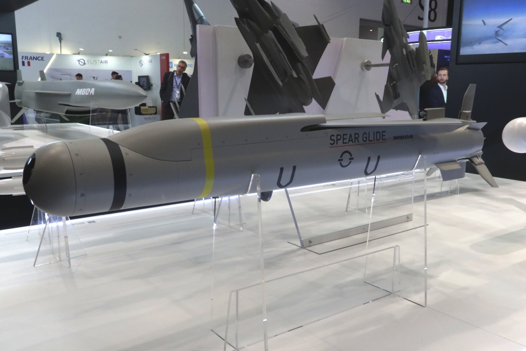
It is capable of engaging a wide range of static and mobile targets in the most challenging operational environments, including soft and moderately hardened fixed sites. A fire-and-forget capability with multiple engagement modes, it provides a high platform load-out, for mass and saturation effects.
I think SAL is reasonably safe bet
Do you realize that even GBU can be used against moving targets? there is ways to predict movements.
How is it using GPS in GNSS denied environments
It has an IR/IO seeker to help guide it
It’s not GPS only
The “image for navegation”… already said it on my first post.
GNSS guided weapons are fire and forget
With the IR/IO seeker
So the seeker is used for terminal

This doesnt imply that it is used for therminal guidance, they only mentions navigation.
Since other source does mention it, it could be the case, that being said seems to be an awfully small gimbal for a laser seeker
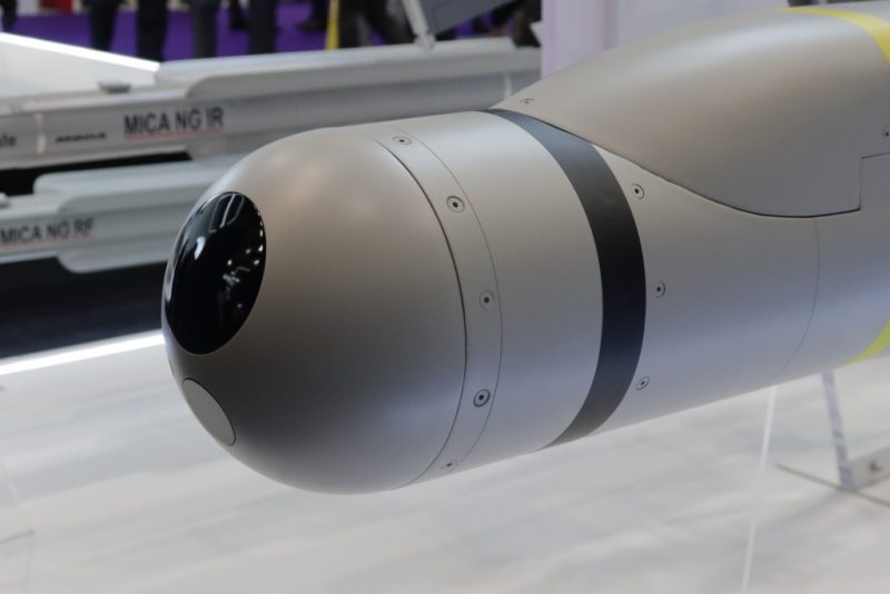
Not only, the RF seeker of the Spear has been replaced by an electro-optic/infrared seeker that allows to do image-based navigation and terminal guidance even in GNSS-denied scenarios, EDR On-Line understanding that the seeker exploits heavily the work done on the Crossbow seeker. Two newly developed key algorithms are loaded in the processor, one dealing with image-based navigation, the second dealing with target identification. It is also being fitted with a SAL (Semi-Active Laser) seeker, which will allow to further increase accuracy when the target is illuminated by a third party designator, air- or land-based. - Source
How is it going to guide in terminal with no GPS
IR/IO does the terminal that is just it
How big does it really need to be?
GNSS/Image navigation to the target area. SAL to nail the precise target. Just like it is on the Brimstone
Don’t forget the f14D
1 Like
Most sources only mentions navigation tho


by increasing target probability, normally GPS are on all of the battlefield, it could pretty much funtions as a quasi navegational radar.