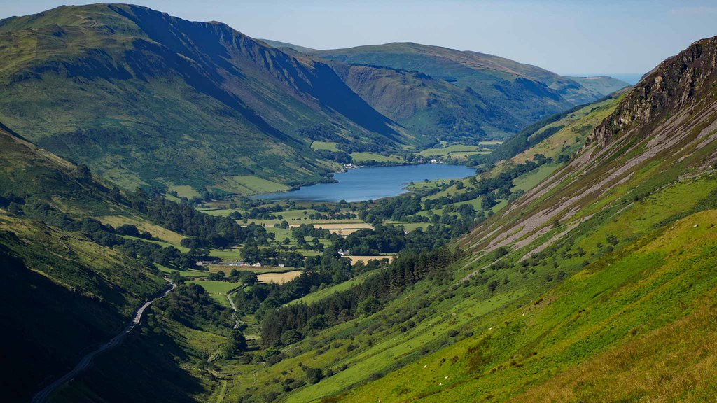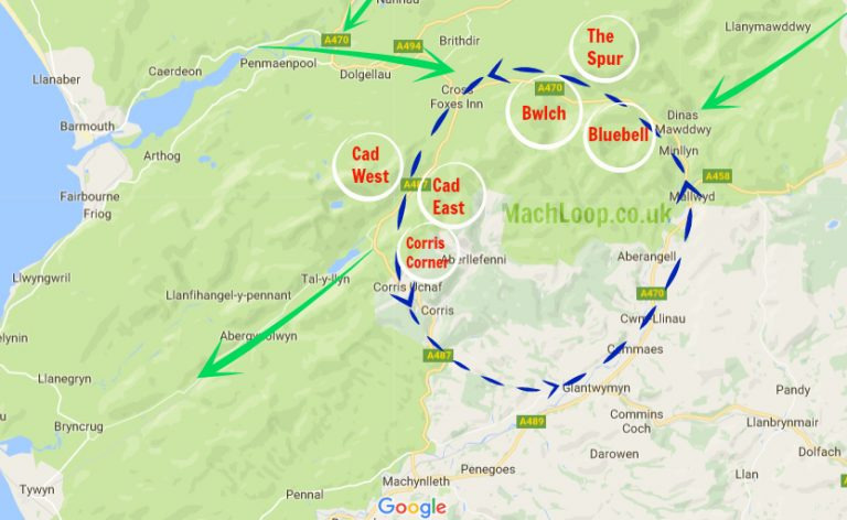
The Machynlleth Loop, better known as the Mach Loop, is a network of valleys located in North Wales and is used by the Royal Air Force, United States Air Force, and various other visiting air forces for low level flight training. It is famous for it’s incredible sights of fast moving jets, heavy cargo planes, and on the rare occasions the odd massive air to air tanker or helicopters. Popular with plane spotters it offers an incredible experience of seeing military aircraft flying as low as 250ft which from the right vantage point often lets you look down at the passing aircraft.
The Mach Loop is located in North Wales on a stretch of the A487 between the towns of Machynlleth (where it derives it’s name from) and Dolgellau.
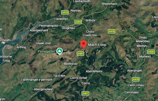
Whilst the Mach Loop is roughly just 20km x 20km a map containing it could be extended to the surrounding area to fit the size of the rest of the maps in-game such as:
64km x 64km (Size of most standard top tier maps)
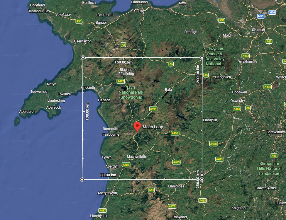
This would include a lot more valleys, hills, mountains, and a body of water whilst also having some flat terrain suitable to place airfields. Bombing targets could be placed within the valleys requiring players to either navigate the terrain or fly high.
128km x 128km (Size of Enduring Confrontation maps)
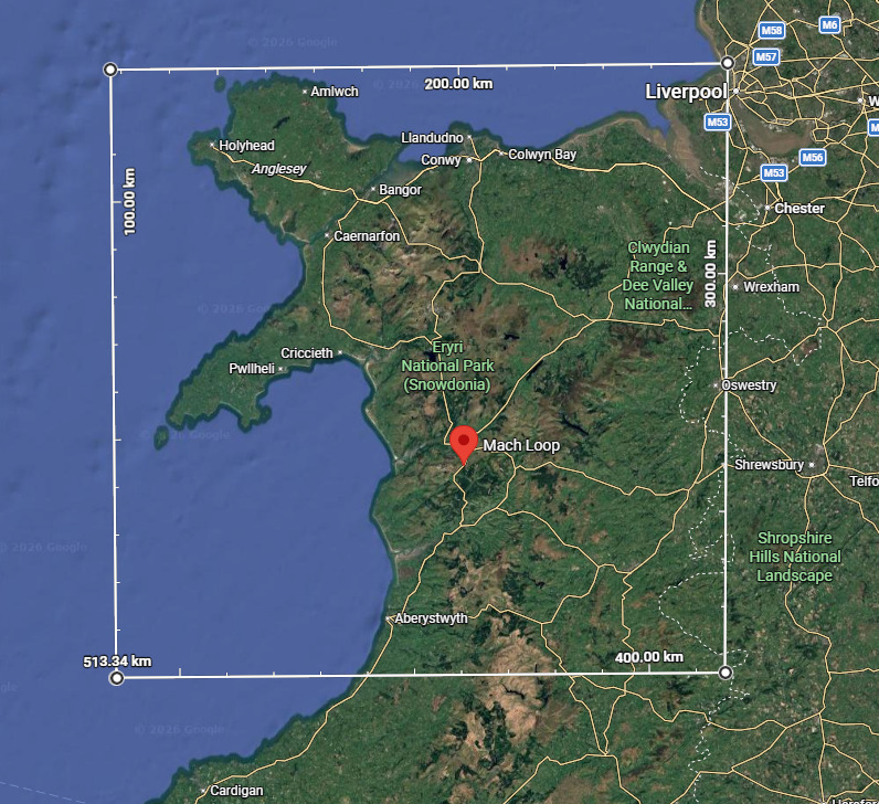
This would be a much bigger area covering the vast majority of Mid-North Wales and further expand on the features that the previous size would by also including another RAF training area, RAF Valley located further north based on the Isle of Anglesey. It would give plenty more opportunities to add various targets and threats and much more room to play with.
256km x 256km (Size of Tropical Coast, the new largest map in-game used in Nuclear Escalation)
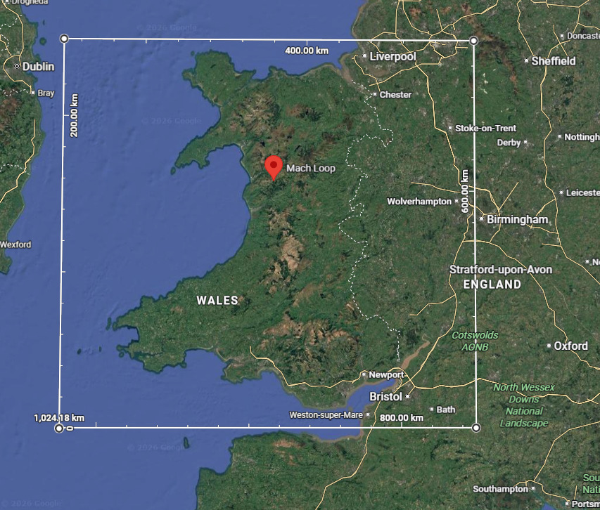
This would include the entirety of Wales along with a big chunk of Mid-West England and chunk of the Irish Sea. This once again would expand on the area of the last iterations however instead could be renamed to LFA (Low Flying Area) 7 as this contains that entire area. This would give plenty of room to populate with airfields, bombing/strike targets, naval assets, or potentially even AI air targets such as AWACS aircraft or air to air tankers.
As you make the map larger to fit the games standard you do start to lose sight of what the map is based around so separate names might be in order to fit them better but I believe it could make for a good map to be added to the game. It would be somewhat similar in play to the EC version of the Afghanistan map but the actual play area would be filled with more obstacles and varied terrain giving more of a challenge and opportunities to use the terrain to your advantage.
Would you like to see this in-game?
Which version(s) of the map would you like to see?
Sources
Google Maps : Mach Loop
MachLoop.co.uk
7 Likes
very interesting training area
I can see where you are coming from, with the whole Mach Loop.
But I feel that as a regular War Thunder map, it doesn’t really add anything. However I don’t really play a lot of Air.
Of the sizes you have suggested, i feel that the whole 256km x 256km map would be the most interesting, since it is just the entirety of Wales.
One place i feel that it could work very well as a map would be for the test flight, so you can try out high speed low level flight. There the 64km x 64km would work well, since it also have coastal area for naval targets in test flight.
I really want more map like DCS where you can abuse from the topography, it really adds another dimension to fights, and can bring more easily gun dogfights.
+1 !
Could be very fun in sim.
1 Like
Unfortunately I can’t see a Loop style map being very good in the WT environment. The Loop itself would offer occasional very fast head ons, but if you drift off the circle I can’t see it offering anything new vs a standard mountainous map.
Before the Mach Loop became the go to place for low level training a very common place to see ground huggers was Dartmoor, the centre piece of Devon to the south.
I used to hike the moor frequently and saw everything you could imagine skimming below me through the valleys below the Tors. During the Cold War especially anything based in the UK (and a few visitors too) could be spotted at lower altitudes than you were stood. F-4s, F-111s, F-16s, Tornados, Jaguars, Mirages, Hawks, Hunters, Hercules, Helos galore…even B-52s, KC-135s, and exotics such as Nimrods (they were based nearby at St Mawgan, a rare but welcome bit of variety) skimmed the upper levels.
Similar terrain to the Mach Loop with Peaks and Valleys galore, but a more traditional East-West style map more suited to the game . Plenty of real life towns, airfields, coastline etc that could be used as inspiration, plus a long history of Military presence for all the UK services, most famously vs the Spanish Armada but also Plymouth based Gladiators battling the Luftwaffe in 1940, and Sunderlands hunting Uboats from Plymouth Sound.
Yes I’m biased, but a peninsula like this with Dartmoor at its small scale heart would be a great starting point for a WT map.
Does this mean I get to blow up your house? +1 for me.
Definitely no Cornish Bias here
1 Like
If they bother modelling it.
Or if they do if you can read the street signs to find it.
More importantly though could hit some parts of Birmingham so that’s a win for me.
1 Like
Could also be a good nuke thunder map use the loop to avoid SAMs and execute seed missions. Using topography is a way to go hunt a SAM but not ideal.
Would be a perfect Air map that can accommodate all battle ratings and some proper-sized sim/EC maps if built to 256KM^2
the loop itself would offer a perfect rat run for strike/bomber aircraft too while being absolute cinema. Wales is a beautiful country with only Scotland rivalling it IMHO
1 Like
I’ve been through it in a Hawk T.1 a few times (UAS AEF flights about 18 years ago).
Would be a nice to have in WT, if not its pretty well modelled in MSFS 2020 & 24, there’s also a really nice Hawk available if you’re interested. Start up to shutdown back at Valley with one lap can be done in about 15 minutes.
Edit:
We just so happen to be getting a Hawk T.1A in the next Major Patch, tech tree and premium versions, no Aim-9L’s on either though for BR related reasons.