- Yes
- No
Introduction
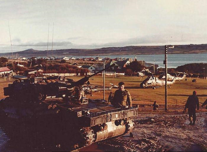
Port Stanley is the capital and main population centre of the Falkland Islands, and was therefore the focal point for operations in the 1982 Falklands War between Britain and Argentina. Armoured vehicles played a small but significant role in the Falklands War, with no main battle tanks being deployed due to the harsh terrain and difficulties concerning tanks and ocean-crossing amphibious operations.
However, various tracked and wheeled lighter vehicles did see combat. The British fielded Scorpions and Scimitars, which proved adept at navigated the rough terrain, performing reconnaissance and provided fire support where needed. The Argentinians deployed AML 90s, used to assert control over the population of Port Stanley, as well as amphibious LVTP-7s, used to land Argentinian forces in the early stages of the invasion. Port Stanley is no stranger to the rumbling of tracks through the streets.
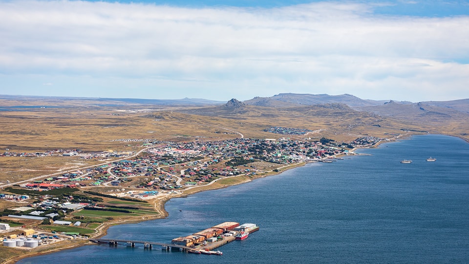
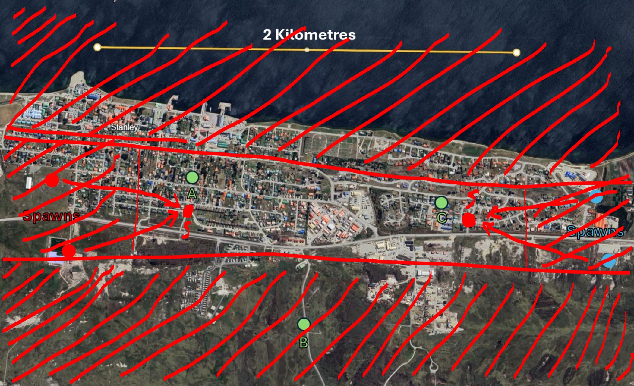
Port Stanley is a small city, with a population of about 2500 and a length of about 2 kilometres. It is generally aligned in an east-west direction, with a small inlet known as Port William/Stanley Harbour to the north, the main city in the centre, and open moorland to the south. Following the upcoming air map covering most of the Falkland Islands, now would be the perfect time to consider a ground forces counterpart.
In-game
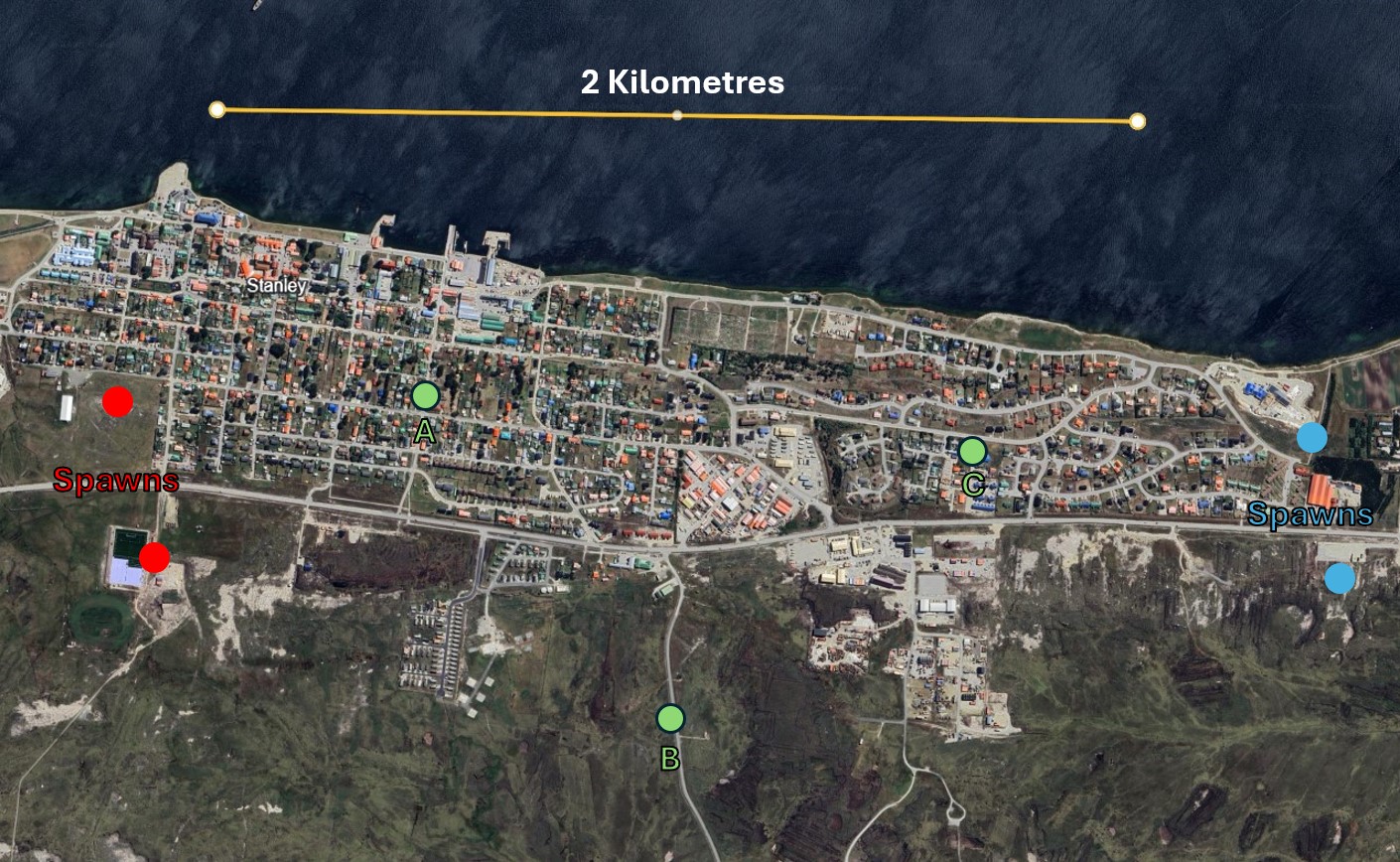
An example of a potential spawn/cap layout for a Port Stanley domination game. Modern day imagery.
In-game, due to Port Stanleys distinct layout, architecture, and surroundings, the battle map will be varied and unique compared to anything we else we currently have in game. Players who prefer short-range, urban combat will be able to knife-fight in the city centre, players who prefer to play long range, hull down, sniping fights will be able to fight in the open moorland to the south, and players who love to take their BMPs for a swim will be able to dive into the frigid waters of the south atlantic to the north. A series of well-made roads running east-west provide high-risk, high-reward routes deep into enemy territory.
Gallery
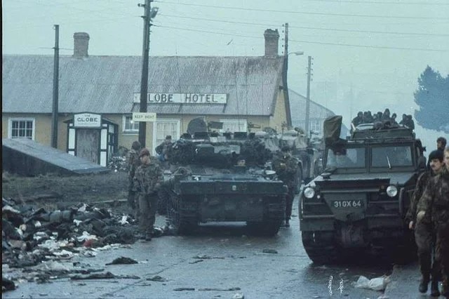
British Scimitars endure the miserable South Atlantic weather in front of the Globe Hotel, Port Stanley
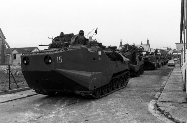
Argentinian LVTP-7s patrol the streets
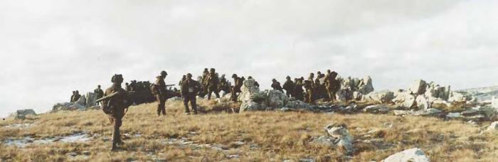
British CVR(T)s on a ridge overlooking Port Stanley
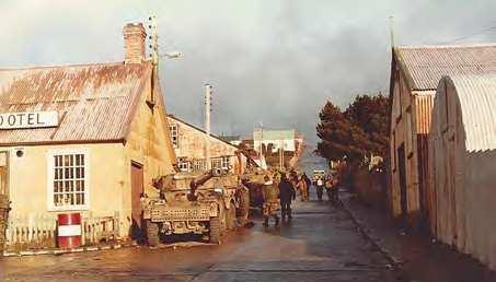
Argentinian AML-90s line the streets after the surrender
Sources