- Yes
- No
- Yes
- No
- Yes
- No
- Yes
- No
Good day!
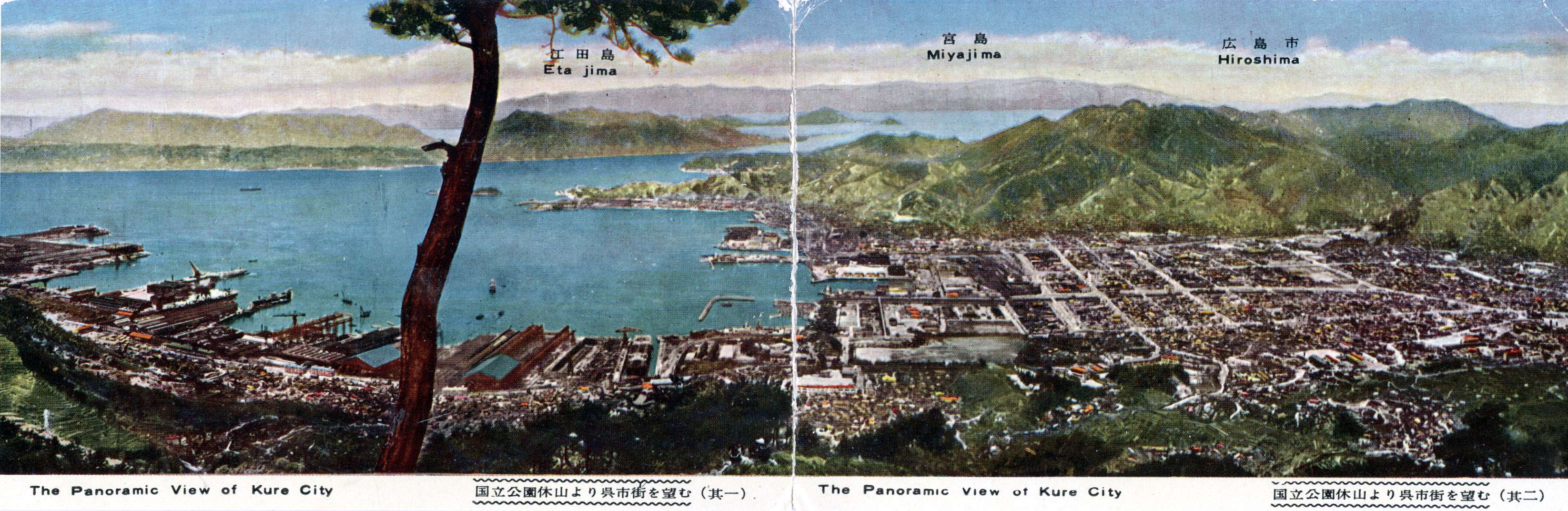
I would like to propose a new map for rank V+ Naval. This is the Seto Inland Sea in Japan. It is a large, scenic archipelago inside the Japanese mainland, featuring tall islands scattered about, ports, shrines, and bridges.
Now, I am aware that we already have the map “Japanese Port” which seems to be inspired by this very location, but that map is a heavily downscaled and simplified form of the real location, and is far too small for the ships we have.
This is my first suggestion, and I am not incredibly familiar with the area, so please bear with me.
History
The Seto inland sea is a large enclosed sea in Japan which is bordered by several prefectures, with the Oita prefecture in its westernmost portion, and the Osaka prefecture in the easternmost one, spanning around 450km west to east.
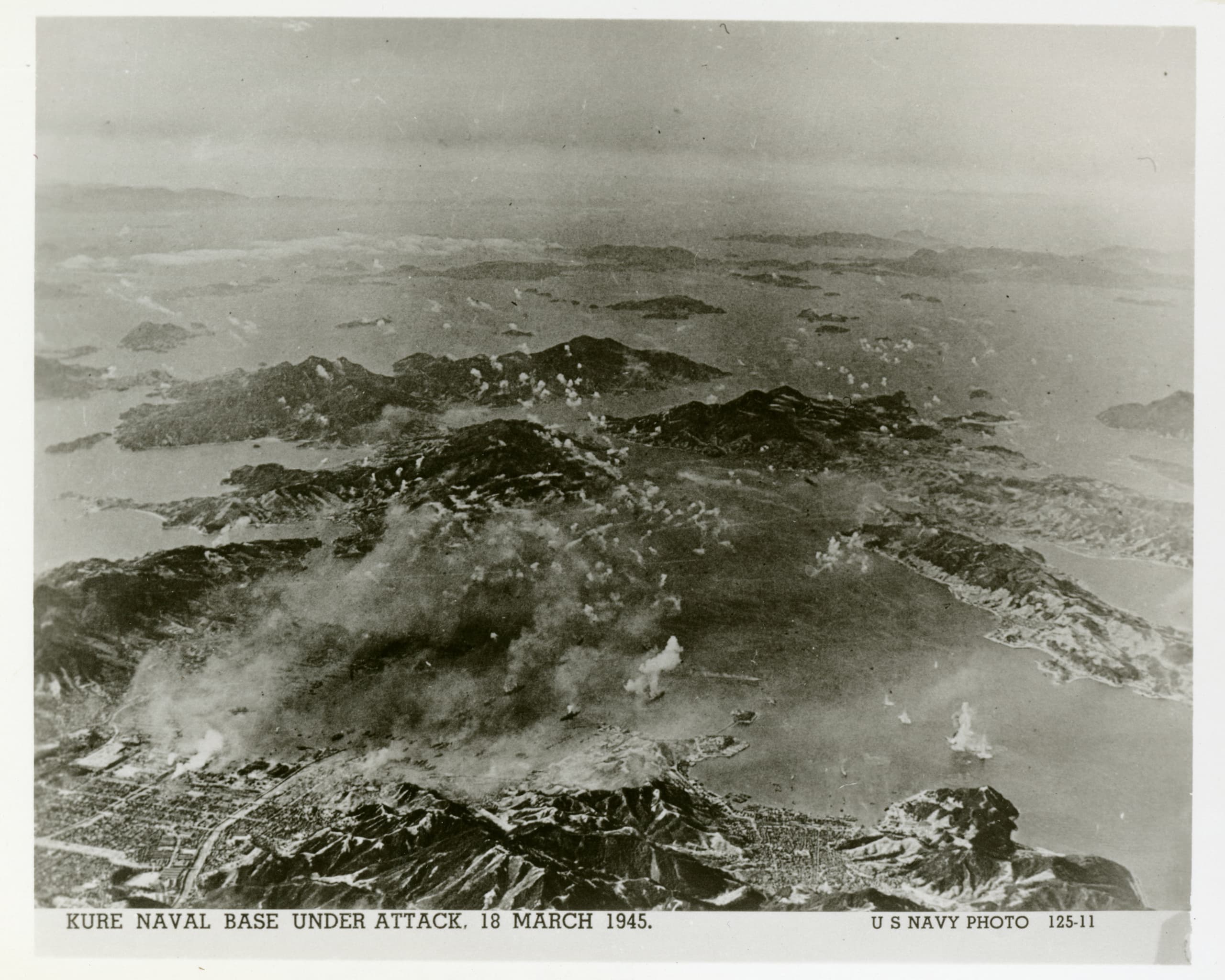
During the Imperial Japan period, the Kure Naval district oversaw the Seto Inland sea, as well as other territories. Kure has an extensive naval history, as it was the stage for the Kure Naval Arsenal, one of the most significant shipyards of the IJN, and responsible for vessels such as Yamato, Nagato, Akagi, Settsu, Atago, I-400 and many more. It was also the stage for production of large amounts of naval weaponry, docking areas, staging grounds, and various training schools.
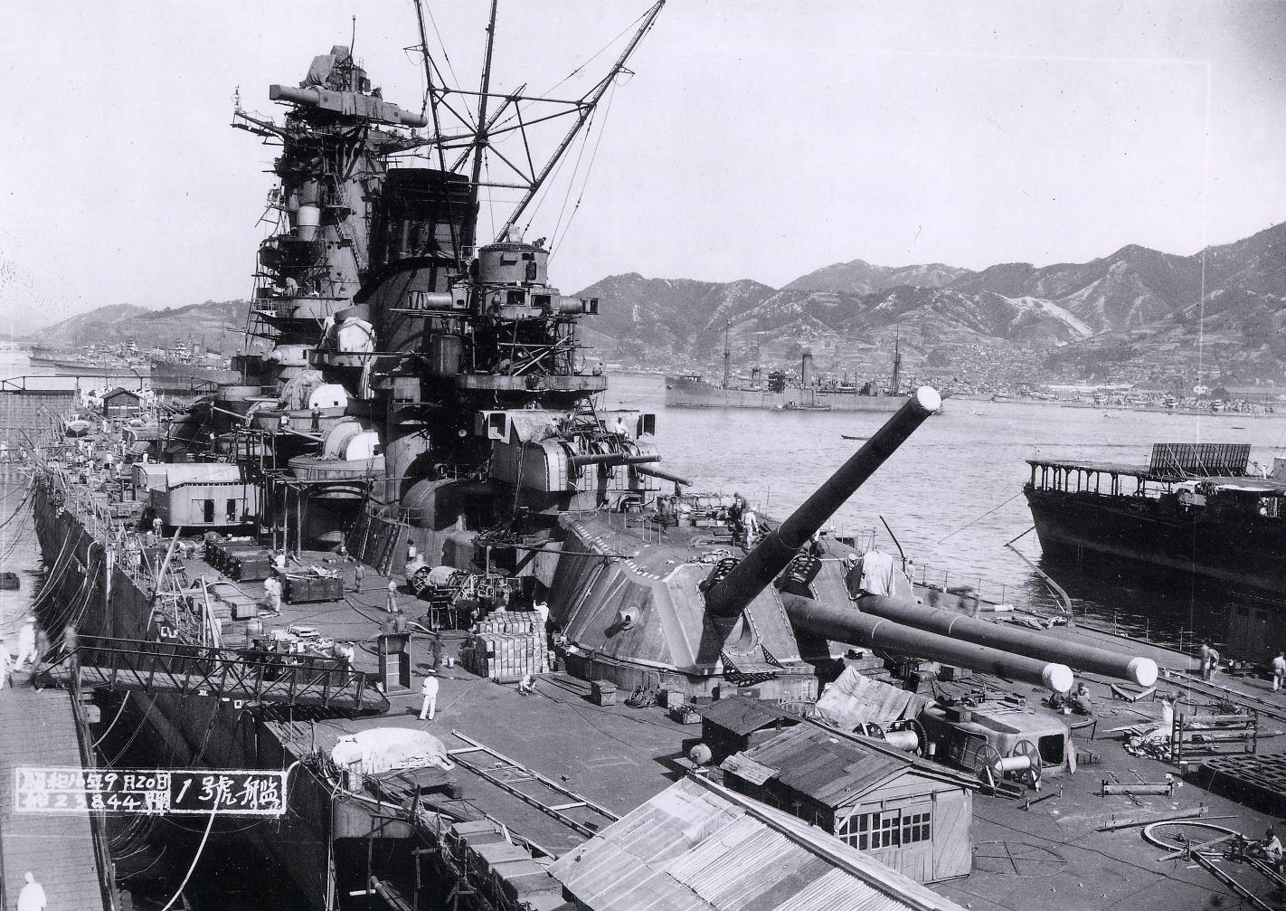
[The battleship Yamato being fitted out in Kure, 20 September 1941]
As the war came to its late stages, Kure would become the target of large-scale attacks by the USN’s Third fleet in July 1945.
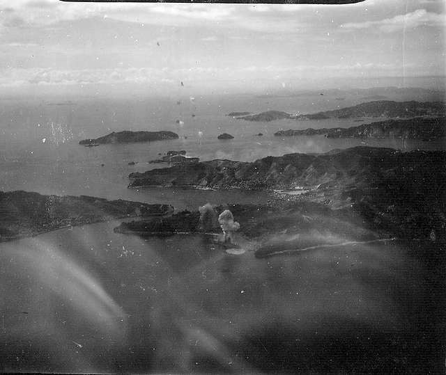
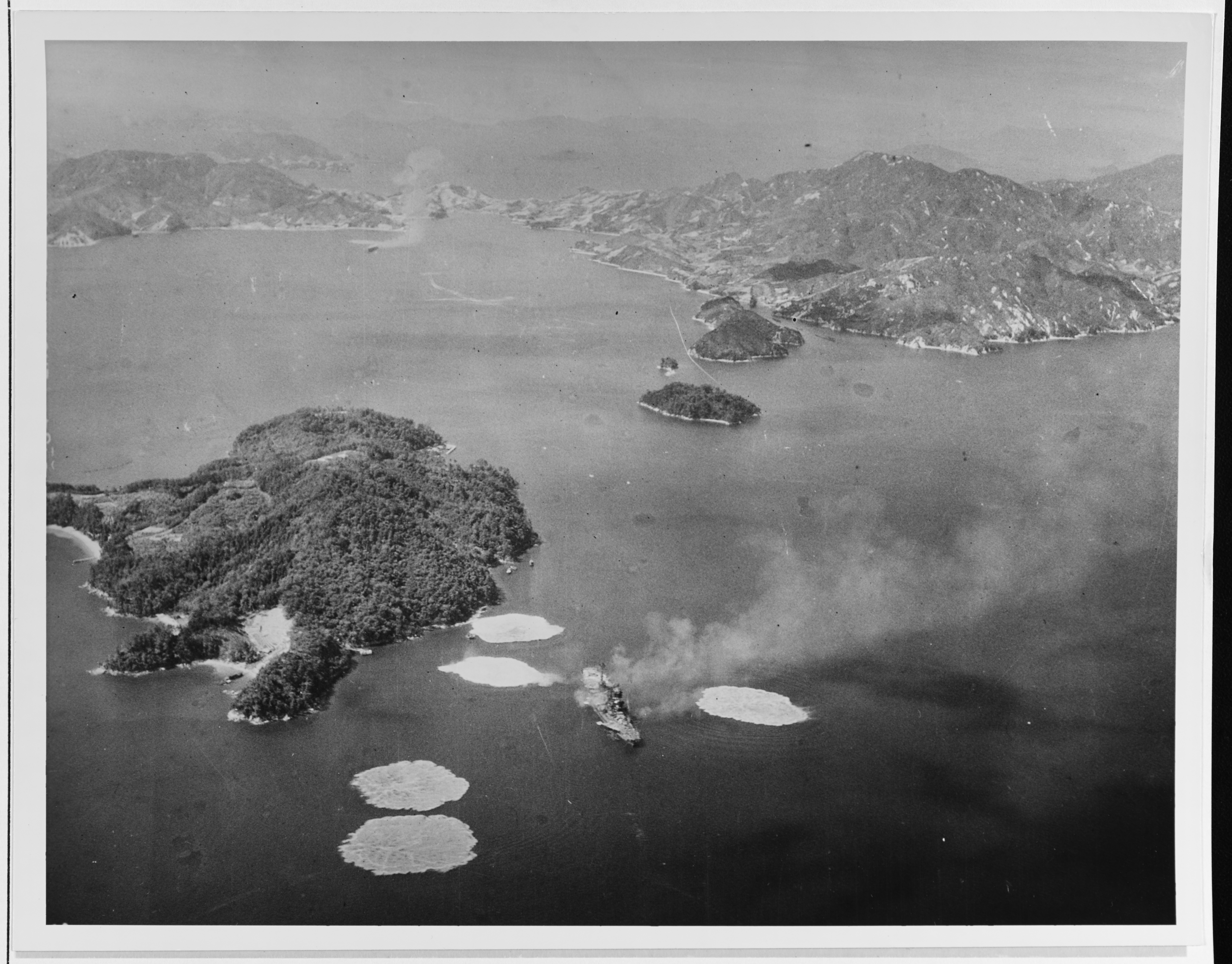
[The battleship Ise burning at Kure. 28 July 1945]
Several ships were sunk during the action, including the battleships Hyuga, Haruna, Ise, as well as numerous carriers, cruisers, and smaller ships.
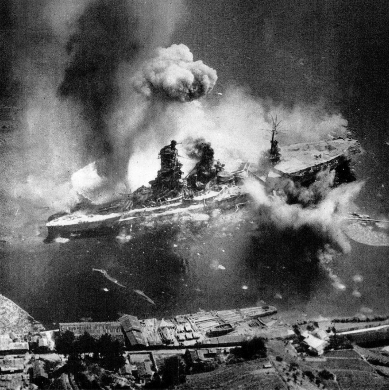
[The battleship Hyuga being bombed at Kure]
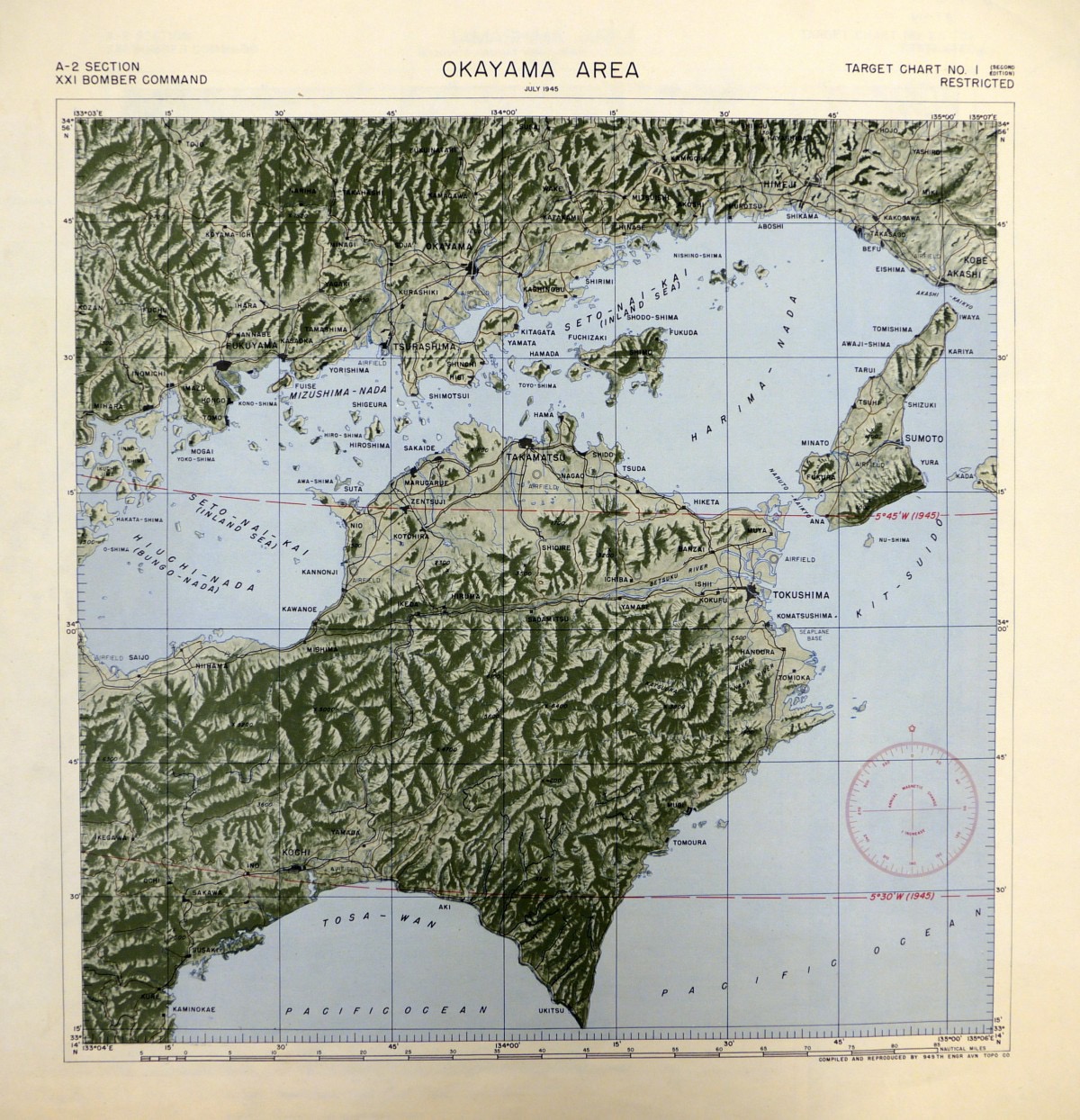
As for the Bisan Seto, it has not seen as much action involving shipping as the Kure Naval Yard, but further east, the Yashima anchorage did briefly host Yamato, Fuso, Nagato, Amatsukaze and Hatsukaze in 1943. Two years later, on the early morning of the 4th of July 1945, the Takamatsu Air raid took place during which more than a hundred B-29 bombers fire-bombed the city in the Kagawa prefecture, leaving most of it in ruins. To the north of the sea, Okayama was similarly the target of bombing from B-29s and too were other cities.
Nowadays, the Seto Inland Sea serves as a major lane and hub for maritime transportation, fishing, heavy industry activities, and offers scenic views to visitors.
Three versions of the map could be added. One for regular battles, an extended one for EC, and a location around Kure for EC
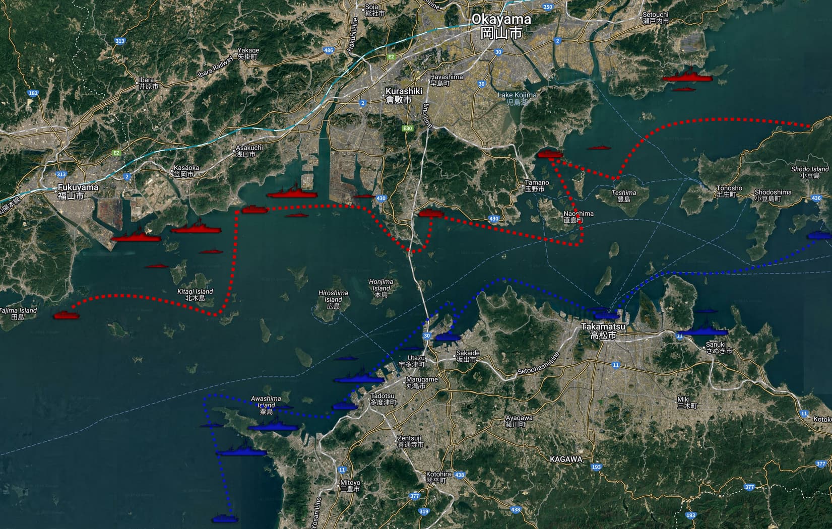
Implementation - Regular Battles
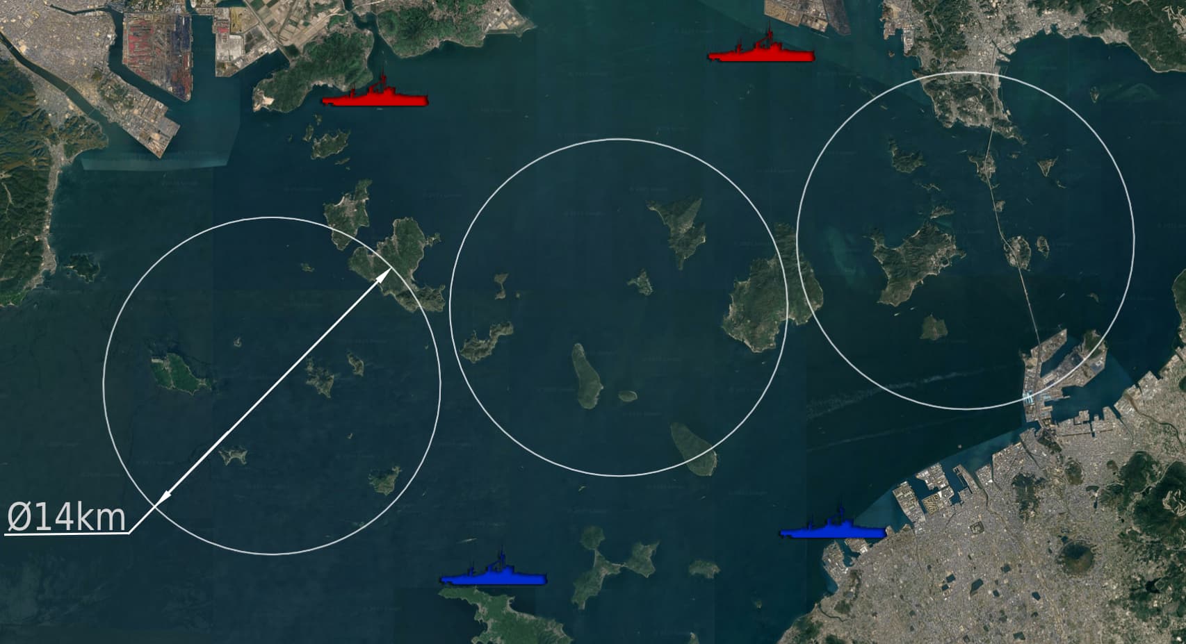
The map would encompass the Bisan Seto which is the area bound between the Okayama prefecture and the Kagawa prefecture. If given a 1:1 scale, the version for regular battles would be around 30km east to west and 22km north to south. Whether this is suitable for the game or if a slight downscaling is needed is to be seen. For gameplay purposes, altering some of the islands is advisable. This would consist of cutting up some lanes in the Hiroshima, Honjima, and Kitagi islands and repositioning some islands to allow for more freedom in maneuvering and route options which would add some replayability. Some islands and other means of cover might have to be created to reduce sightlines into the spawns.
For domination: The location of the spawns and their distances from that of the other team and the objective should depend on the rank of the battle. The proposed layout image was made with battleships in mind, however for cruiser battles, the spawns should be brought closer to each other and the capture points shrunk, so as not to make the map unnecessarily large.
I suggest that the capture points be made far larger than they currently are, say ~14km in diameter. This will reduce the sailing time needed before reaching the capture points, and would allow players to push into the objectives without necessarily overextending and becoming a big target. Care should be taken when setting ticket bleed so as to have proper match pacing.
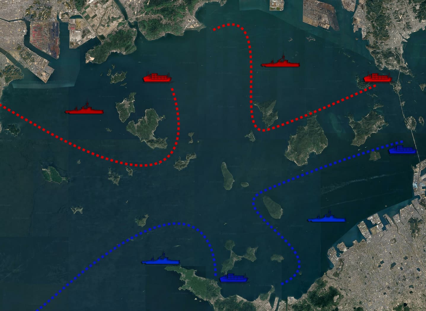
For encounter: This is a more complicated topic which deserves its own thorough discussion, and I think that encounter in general can be greatly expanded upon, as its current implementation is quite simplistic. But for this map, having two or more moving convoys rather than the stationary ones we have on all but one map, ideally with a more complex path than a straight line [see dashed lines], could make the gameplay more interesting.
I have included an idea of how it could be added, however I have not gone through thorough analysis of sightlines and such. If balance allows it, the convoys could be Japanese & American&British rather than the German fleet we are used to. There are models of Liberty ships, SS Ohio, and Kashino in the files which could be used as substitutes to the German Goldenfels cargo ship.
Implementation - Enduring Confrontation
As enduring confrontation maps are based off of real-life locations, this map should be added geographically unaltered. To make the map larger, the area east of the Seto-Ōhashi bridge until Sanuki and Setouchi can be added, and possibly also slightly extended to the more open waters in the west.
Alternatively/additionally, a separate map can be implemented which would take place near Kure and in the Akinada part of the inland sea. It could extend to perhaps ~60km-70km south west of Kure and include some of the area in the Hiroshima Bay. This section would be more historically significant compared to the Bisan Seto.
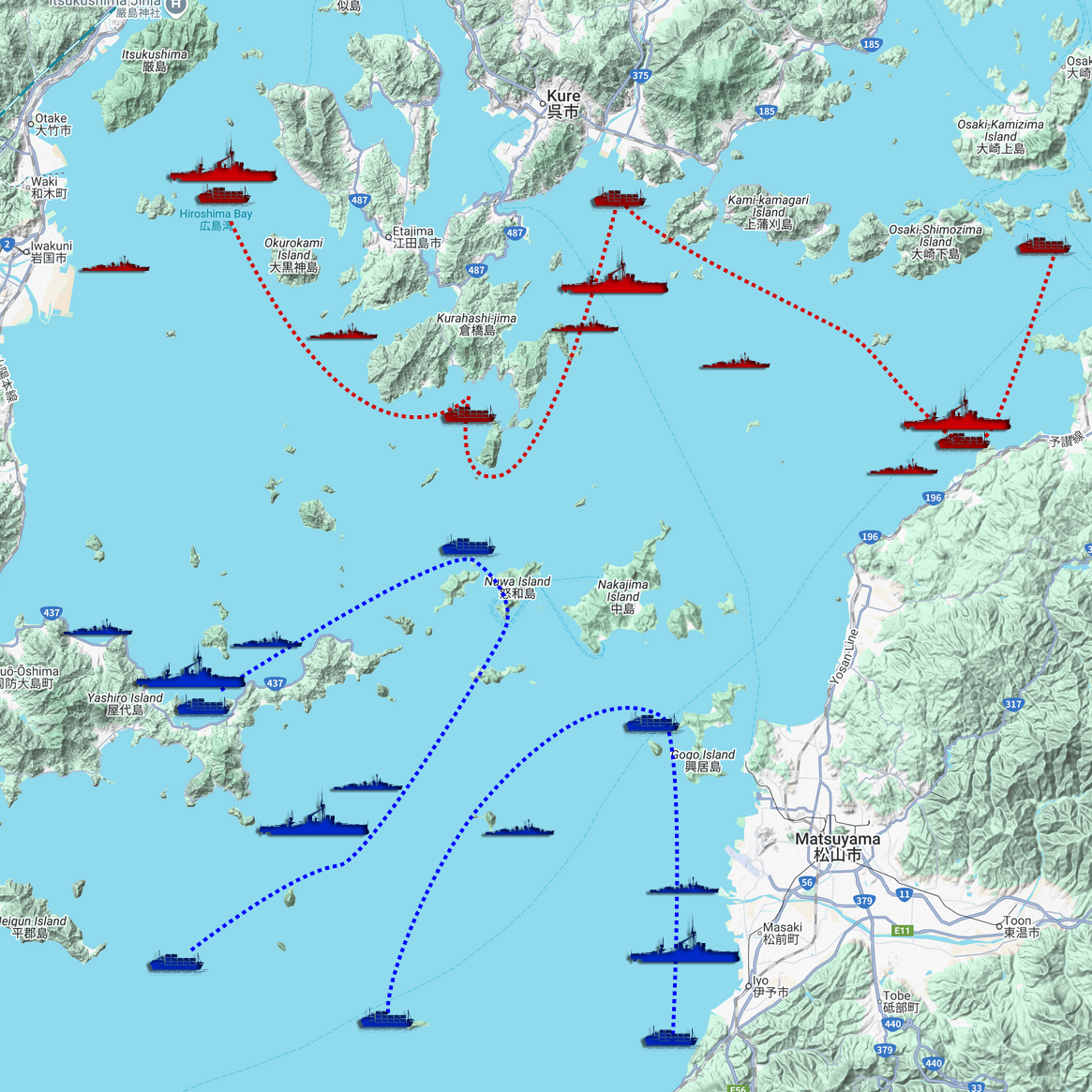
In both cases, additional objectives could be scattered near the islands and the shores rather than restricting them to the main ports, but I have not included them in the proposed layouts.
Sources
WW2DB Yashima
Hackett Bob, Kingsepp Sander, 2000-2016, IJN Battleship YAMATO: Tabular Record of Movement, combinedfleet.
Attacks on Kure and the Seto Inland Sea - Wikipedia
瀬戸内海 - Wikipedia Japan
Thomas G.M., (2025, January 19). Okayama Bombing 岡山大空襲(おかやまだいくうしゅう)
Kure Naval District - Wikipedia
Sundberg, S. (2021, October 5). Kure Kaikokan (port of Kure), c. 1920.: Old Tokyo. Old Tokyo | Vintage Japanese Postcard Museum.
WW2Online | The Digital Collections of the National WWII Museum
Nos. 247 through 250, Takamatsu, Kochi Himeji and Tokushima, 3-4 July 1945. Report No. 2-b(58), USSBS Index; Section 7 (文書名:Records of the U.S. Strategic Bombing Survey ; Entry 53, Security-Classified Tactical Mission Reports of the 20th and 21st Bomber Commands, 1945
Thank you for reading!