- Yes
- No
- Oregon
- California
- Both
- Neither
Hello all once again!
After reading up on the subject (and actually having learned most of this while in school, growing up and visiting various sites in the US West Coast), I thought it would be a fun and unique map for War Thunder to add yet another alternate history event based on real incidents. Here I am to suggest the idea of a map based on the idea of an Invasion of the US West Coast!

Context
This idea of a map is based on a handful of real events that happened along the US West Coast throughout WWII. Of course, this is a bit of an exaggerated outcome of said events, as it is extremely unlikely that Imperial Japan would’ve been able to take on such a task, despite the full belief by the US Government and their concerns that the West Coast was not well defended enough. These events include the false raid of the “Battle of Los Angeles”, the “Bombardment of Ellwood”, the “Shelling of Fort Stevens”, the “Sinking of S.S. Fort Camosun”, and the “Lookout Air Raids” just to list the main few. To also support this idea, you can take the “Invasion of the Aleutian Islands” as well, which would also serve as an interesting map.
Here is some more conceptual ideas of this event by LIFE Magazine in March of 1942.


Implementation
The Pacific Northwest (and the whole of the North American West Coast in general) offers very picturesque and unique landscapes, with its rolling hills, lush valleys, tall volcanic mountain chains of the Cascades, and abundant waterways, making it a very interesting yet historically important location especially in the early days of the US joining the chaos of the Second World War.
The main issue is that the West Coast is massive, so that including multiple of these incidents/references to them into one singular map would be hard. And given how undeveloped some parts of the West Coast were at that time, there is a lot of vast space that would be a bit lackluster, depending on the map. So I purpose a few smaller maps that are localized, or at least can be scaled down to properly fit, as just one section of the map would be hitting 160km squared (I previously suggested a scaled Cuba map, and that was already hitting 140km squared at the smallest case!)
Here is a map of just the few instances listed above, you can see that the distances between them all indicate an area far too large to encompass without making concessions and picking a particular area instead, with a total distance between every point being just over 1,700km in a straight line from point to point.

As for airfields in the area, thanks to work needed throughout the Great Depression and into WWII, many were constructed in the late 1920’s and early 1930’s, or even as late as the turn of the decade into the 1940s. My main three main areas of focus are as follows. Northwestern Oregon (Near Fort Stevens and the town of Astoria), the Oregon-California border along the coast (near the Lookout Air Raids), and the city of Santa Barbara as well (Bombardment of Ellwood).
Here is a map of relevant airports and airfields (Blue) for the mentioned areas above (historical sites marked in Red.

And the same for Southern California.

So, very clearly a big choice in where it could be located. As for map sizes, they would be far too big (as mentioned) so they would most likely have to be scaled down. Here are some concepts that I made to entertain this idea.


Important Locations
For an Oregon Concept, some notable locations would be Fort Stevens and Cape Disappointment, Installations made before WWII and further expanded with the thread of Japanese Raids and as a coastal defense of the Columbia River. Then you have the many small Oregon coastal towns, and bigger cities like Tillamook and Cannon Beach, as well as Seaside, Long Beach, and Astoria. Geographical Landmarks like Haystack Rock, the mouth of the Columbia River and its many islands and sandbars, as well as the many caps and splits along the coast. To the Eastern side of the map, you have the Cascade Range, and maybe a peek into the greater Portland Metro Area.
Here are some reference images from that era
Oregon/Washington Landmarks
Seaside Beach with a US NAVY Blimp over Tillamook Head
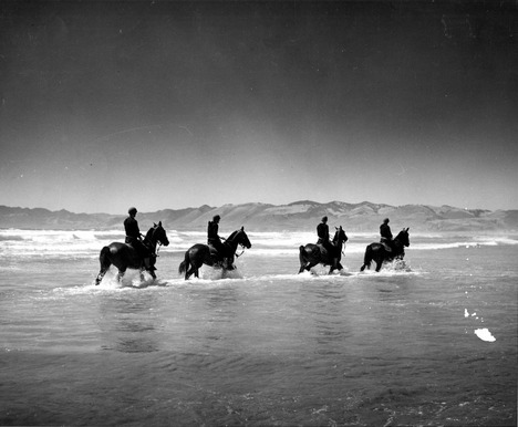
US Coast Guard Personnel patrolling an Oregon Beach
Shells that hit near Fort Stevens from I-25
Haystack Rock, Cannon Beach, circa 1930
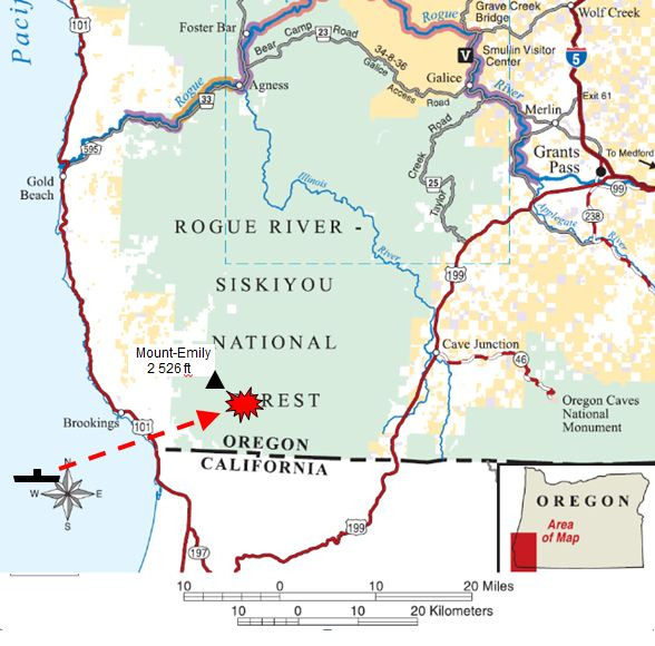
Lookout Air Raid Map
I-25 launching a Yokosuka E14Y floatplane towards the Oregon Coast, Sept. 29th, 1942
Fort Stevens Battery firing
Fort Stevens Aerial View (1937)
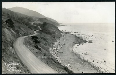
1930s Oregon Coast
Cape Disappointment Lighthouse near Ilwaco
Aerial shot of Fort Camby circa 1937
Astoria, Oregon (postcard) circa 1930s


As for California, the area around Santa Barbara would include a lot of interesting historical locations, such as the ever so famous city of Santa Barbara, the golden California coast and its amazing beaches, and the Channel Islands just south of the city. On top of that, you would have the military installations such as MCAS Santa Barbara and NAS Point Mugu.


This all being said, it is unfortunate that Nation locked map rotations no longer exist, so this map would’ve been more suitable for the game way back when it was more common to see map layouts like this. I don’t think there would be any new objective types that wouldn’t have been seen before, but it would be interesting to represent this genuine fear the US Government had at the time.
In any case, I would like to thank you for your time! Take care!
Sources
TIME Magazine Maps, March 1942
Airfields in Oregon
Airfields in Washington
Images of the Oregon Coast during WWII
Wikipedia Article on the Shelling of Fort Stevens
Wikipedia on the Lookout Air Raids
FortWiki details on Cape Disappointment
FortWiki details on Fort Stevens
Info on Ellwood
Information on Fort Stevens
